Spatial Imagery
Advertisement
ERDAS ECW JPEG 2000 Plug-in for v.11.0.1.250
Digital imagery is becoming more and more ubiquitous as time goes by.
Advertisement
LizardTech GeoViewer v.5.0.0.3065
LizardTech GeoViewer is LizardTech's free, standalone application for viewing geospatial imagery, vector overlays, and LiDAR files.
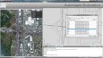
LayerTransparency v.1.0
When working with ArcMap, it is inevitable that you will want to look through layers and see how they overlay on top of the layers underneath.
Korti v.2 8
Korti is a Google Earth plugin which allows you to see the unique 3D satellite map of Korti within your Google Earth application. Korti provides you a detailed satellite imagery and geographic information about this geographic place.
MrSid Plug-In v.1 3
The MrSID plug-in for CARIS installs onto an existing installation of your CARIS product and allows users to add MrSID imagery created using LizardTech's GeoExpress with MrSID software directly into their local CARIS application.
Speleoliti v.3.0
Speleoliti is a powerful and user-friendly software for spatial modelling. It is especially designed for speleological needs (cave mapping software), but also suitable for other kind of geo-works.
Acquiarium v.1 6
Acquiarium is open source software (GPL) for carrying out the common pipeline of many spatial cell studies using fluorescence microscopy.
Geoida v.1.0
Geoida is a software product that will benefit members of the surveying and related professions for the day-to-day routine processing, coordination and adjustment of spatial survey data, from routine pick-up surveys to complex networks of geodetic sc
TatukGIS Viewer v.2.9.0.5307
TatukGIS Viewer opens most GIS/CAD vector, raster image, and grid file types, including the aerial imagery and vector street map data provided by the leading vendors, most ArcView, ArcExplorer, and MapInfo projects,

Automapki v.1.3.3
Automapki application brings web mapping and public satellite imagery to AutoCAD / ZWCAD / Bricscad software to display your project on top of your favourite web mapping source: Bing Maps, Google Maps, Yahoo Maps or Open Street Map.
Automapki x64 v.1.3.3
Automapki application brings web mapping and commonly available satellite imagery to AutoCAD / ZWCAD / Bricscad software to display your project on top of your favourite web mapping source: Bing Maps, Google Maps, Yahoo Maps or Open Street Map.