Spatial Imagery
Advertisement
C# Spatial Index (RTree) Library v.1
The C# RTree project aims to maintain a C# version of the RTree spatial indexing algorithm.
Advertisement
Java Spatial Index (RTree) Library v.1.0b8
The Java RTree project aims to maintain an Java version of the RTree spatial indexing algorithm.
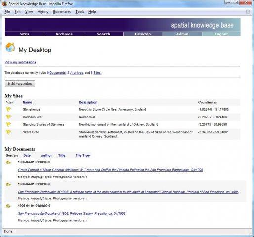
Spatial Knowledge Base v.2.1.3
Spatial Knowledge Base is a web based application for storing and searching of archaeological sites information.
CHIP Spatial/Temporal Cluster Generator v.1.0
The CHIP Cluster Generator attempts to create spatio-temporal cluster data in an automated fashion to help evaluate epidemic detection software.
DualCAD Spatial v.1.0
The DualCAD project is an ongoing project 'over 17 years' to create a freeware cad application that handles the basic needs of most microstation users.
SADA v.4. 1. 1950
Spatial Analysis and Decision Assistance (SADA) is free software that incorporates tools from environmental assessment fields into an effective problem solving environment.
ERDAS ECW JPEG 2000 Plug-in for v.11.0.1.250
Digital imagery is becoming more and more ubiquitous as time goes by.
LizardTech GeoViewer v.5.0.0.3065
LizardTech GeoViewer is LizardTech's free, standalone application for viewing geospatial imagery, vector overlays, and LiDAR files.
Korti v.2 8
Korti is a Google Earth plugin which allows you to see the unique 3D satellite map of Korti within your Google Earth application. Korti provides you a detailed satellite imagery and geographic information about this geographic place.
MrSid Plug-In v.1 3
The MrSID plug-in for CARIS installs onto an existing installation of your CARIS product and allows users to add MrSID imagery created using LizardTech's GeoExpress with MrSID software directly into their local CARIS application.